
Mapping Urban Britain from the Past to the Past: a Scottish view on three episodes in cartographic history
Published: 27th April 2023

Laura Yeoman
@LauraY_archives
Laura is a BALH Trustee and an archivist at the Borthwick Institute for Archives in York.
In this third of four talks delivered in partnership with the Historic Towns Trust, John Moore spoke on the history of urban mapping in Great Britain, placing particular emphasis on Scottish urban centres. John is a Trustee of the Historic Towns Trust, has over 40 years’ experience in researching the history of cartography, and is currently working on the Historic Towns Trust volume for Perth. This fascinating session highlighted a number of key sources that can be used for researching the historic development of urban settings.
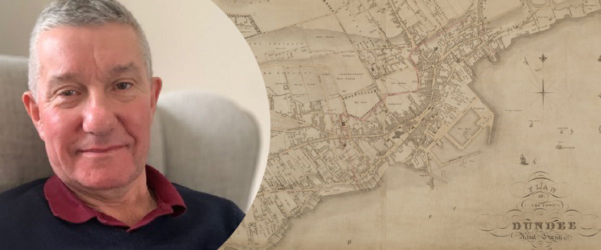
John began by considering the career of John Wood, a 19th century Edinburgh-based cartographer whose plans of Scottish towns were produced between 1818 and 1844. Whilst Wood’s Scottish work is relatively well-known (his surviving plans can be viewed on the National Library of Scotland website), very little is actually known about the man himself. Following the publication of his first Scottish plans (of Ayr and Dumbarton) in 1818, he went on to produce plans of a further 55 Scottish burghs. He also created an extensive series of town maps of England and Wales over the same period, including Carlisle (1821) and Pwllehli (1834).
John also considered the methods Wood may have employed in the creation of his works. His research suggests that Wood worked alone, and in some cases created his plans based – either in full or in part – on earlier surveys produced by other surveyors. In 1828 Wood published his ‘Descriptive account of the principal towns in Scotland’. The volume was designed to accompany his Town Atlas, and includes gazetteer-style information about the key towns across the country (a copy of this work can be found on the Internet Archive website). The volume only included 51 names in its list of subscribers (albeit some high profile names of the time amongst them) and two advertisements for the volume have so far been traced. This suggests a half-hearted approach to marketing which may have thwarted the publication of Wood’s proposed atlas.
Another interesting aspect of Wood’s career was his choice of locations to survey. As John pointed out, notable omissions in his Scottish surveys were Falkirk and Peterhead, both of which had larger populations than some other towns he chose to survey. In England and Wales, he concentrated his efforts on small and medium-sized towns. John argued it was possible that Wood deliberately avoided areas where there was more competition or which had already been mapped. These questions definitely warrant further research.
Secondly, John considered the work of the Ordnance Survey in urban mapping, and in particular, the rare six inch to the mile series of Town Maps. Between 1919 and 1921 the Ordnance Survey published this small series of 22 coloured, single-sheet maps, each with a full street index. The first in this series was Southampton (home to the Ordnance Survey) and interestingly Dundee was the only Scottish city mapped. The rationale behind the choice of locations for this series has not really been fully understood – John suggested the choices might be down to proactive bookshop owners (who would be selling the publications locally) or the enthusiasm of Ordnance Survey staff in those areas.
The Town Maps series was revised between 1931 and 1935, but in John’s opinion this second series was a poorer version of the first – the maps are uncoloured and unrevised issues of standard maps, on cheaper paper and without standardised indexes. John pointed to the constrained finances of the Ordnance Survey in the interwar period as a reason for this change in publication quality, and noted that this second series of Town Maps bears a resemblance to the series created for ARP purposes prior to the Second World War (known as the Special Emergency Edition maps). Although additional Town Maps were produced in the 20th century, the series was nowhere near comprehensive.
Lastly, John detailed the development of the Historic Towns Trust over the last 60 years. Originally formed in the aftermath of the Second World War as a pan-European project, the work of the Historic Towns Trust has been vital in creating atlases of British cities at a consistent scale, allowing for a direct comparison between towns. Each sheet within an atlas reflects an aspect of the history of the particular settlement.
The Trust’s future plans include the expansion of the series to create more balance across England, Scotland and Wales, and the creation of volumes on model towns and resort towns. As John pointed out, there are sizable areas of the country without a map or an atlas, and it’s important the Trust takes care in selecting which areas to map (and in which order). The ultimate plan is still to have produced at least one volume for every historic county or regional authority in Britain by 2050.
The Historic Towns Trust relies heavily on local historical and archaeological groups, and volunteers are needed to support the research into their local area. With each atlas costing around £30,000 to produce, fundraising for a publication is particularly important. Overall, John’s talk was a great chance to learn about urban mapping over time, and covered a number of vital sources for local history research. He also issued a ‘call to arms’ for new volunteers to support the work of the Historic Towns Trust. If you’re looking for a new project, that might be the one for you!
The views and opinions expressed in this blog are those of the author and do not necessarily reflect the official policy or position of the British Association for Local History (BALH). Any content provided by our contributors is of their own opinion and is not intended to malign any individual, group, organisation, or entity.


